

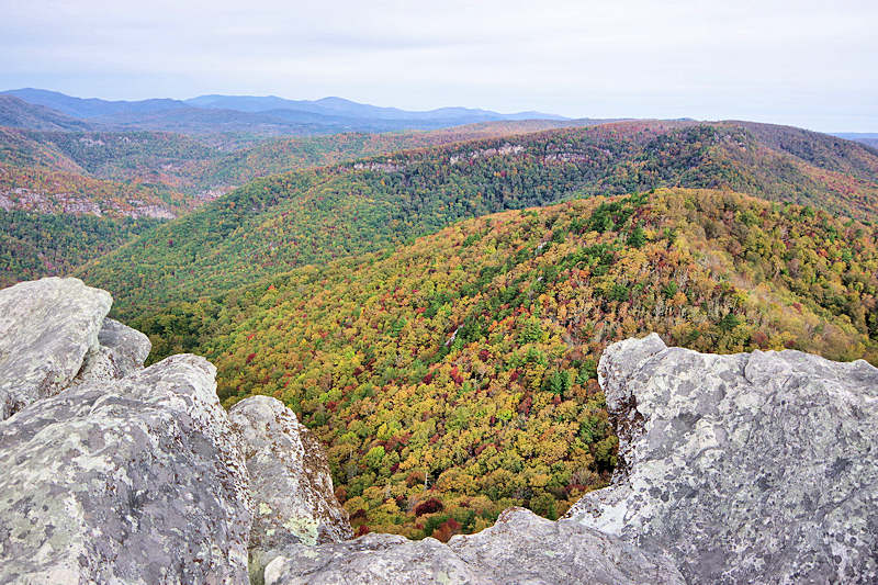
The distinctive summit of Hawksbill Mountain overlooks the beautiful Linville Gorge – often referred to as the “Grand Canyon of Eastern USA”. A 1.5-mile roundtrip takes you to the rocky summit, elevation 4,009 feet, for panoramic views of the Blue Ridge Mountains. The Linville River runs about 2,000 feet below. While the trail is short, you gradually walk uphill to gain 700 feet in elevation. On top, find plenty of rock outcroppings to explore and sit on to enjoy the 360-degree vistas.

The trailhead to the Hawksbill Mountain Trail is about 19 miles south of Sugar Mountain. It’s inside the 12,000-acre Linville Gorge Wilderness Area, which is part of the Pisgah National Forest. The last 2.5 miles of the drive is on an unpaved bumpy road – not recommended for low clearance vehicles. It’s a popular hike, so go early or late especially on weekends to avoid larger midday crowds.
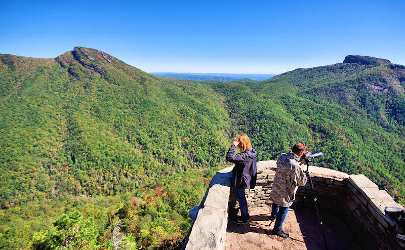
The trail up the mountain is easy to follow, but take your time as it gradually gets steeper and more rocky. When you reach the summit, go left and right to explore different areas of the stone peak. Go to the left for great views of neighboring Table Rock. Go right for the more expansive views and plenty of great picnic spots.
It’s definitely a “top of the world” experience. Many wedding proposals have been made here. Be careful of sharp drop-offs! Watch your step, and keep children close to you and dogs on a leash.
Hawksbill Driving Directions from Sugar Mountain
The Hawksbill Mountain hiking trail is about 19 miles from Sugar Mountain. Here are driving directions from Sugar’s main entrance:
- Turn right onto NC 184 S
- At stoplight at NC 105, turn right toward Linville
- At next stoplight, turn right onto US 221 South
- In about a half mile, turn left to stay on US 221 South
- In about 3 miles, turn left onto NC 181 South
- In about 6.3 miles, turn right onto Gingercake Road (the second intersection with Gingercake Rd – look for sign for Table Rock and Gingercake Estates). This is about four miles south of the Blue Ridge Parkway intersection.
- A half-mile down Gingercake Rd, stay left on National Forest Road 1264 toward Table Rock. The pavement ends in a mile.
- Continue another 2.5 miles on the unpaved road to the Hawksbill parking area on left. The trail is on right side of the road.
Note: The National Forest Service road is normally open year-round to Hawksbill, but sometime closes due to wintry weather.
Here’s the Hawksbill Mountain summit (on left) as seen from Wiseman’s View located across the Gorge about 4 miles past the Linville Falls parking area on Kistler Memorial Highway (unpaved) in Pisgah Forest near the town of Linville Falls.
Nearby Twin Hike: After hiking Hawksbill, drive 4.5 miles more on the bumpy road for the trail to the top of Table Rock Mountain with a very similar rocky summit. That hike is two miles round-trip, so you can easily do it on the same day.
More: See our Top Hikes Guide for more trails and waterfalls and Top Things to Do near Sugar Mountain.