
Take a beautiful loop hike utilizing the scenic Cragway Trail and several other trails inside Grandfather Mountain State Park. The trailhead is located on the Blue Ridge Parkway, about 15 miles from Sugar Mountain. This 4-mile hike climbs steadily about 1,000 in elevation. The sign at the trailhead at Boone Fork Overlook says 3,410 feet elevation – but it’s actually 3,900 feet. This hikes tops out at an elevation of 4,967 feet at Flat Rock View.
It’s a strenuous but non-technical hike, and the trail is easy to follow. Hiking shoes are definitely recommended. The Cragway Trail section has rock outcrops and a few steeper sections, so watch your step. Intersections are well marked. See the map at the bottom of this page.
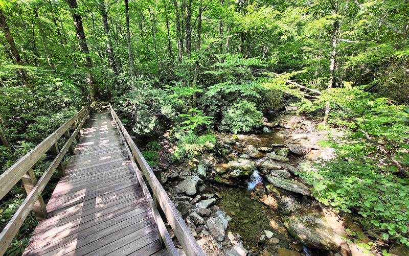
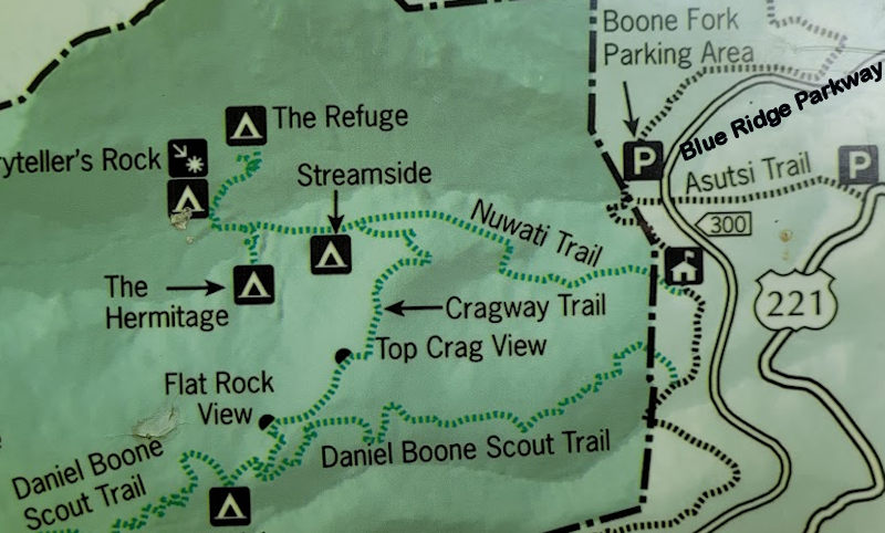
This hike begins at the Boone Fork Overlook at Milepost 299.9 on the Blue Ridge Parkway (halfway between the Linn Cove Viaduct and Price Lake). Begin the hike on the south end of the parking area – to the left as you face way from the Parkway. Shortly, you’ll cross the beautiful footbridge over the cascading Boone Fork Creek. Then stop at the kiosk to complete a quick, free hiking permit. Continue a wooded walk for 4/10 of a mile to reach the Nuwati Trail.
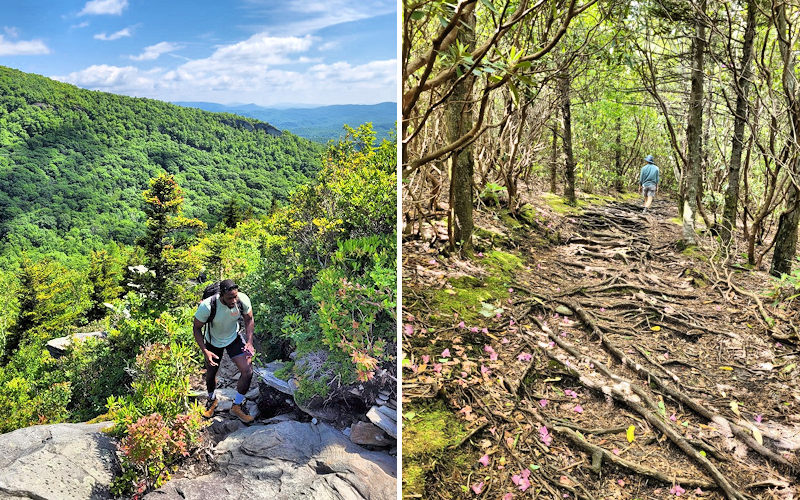
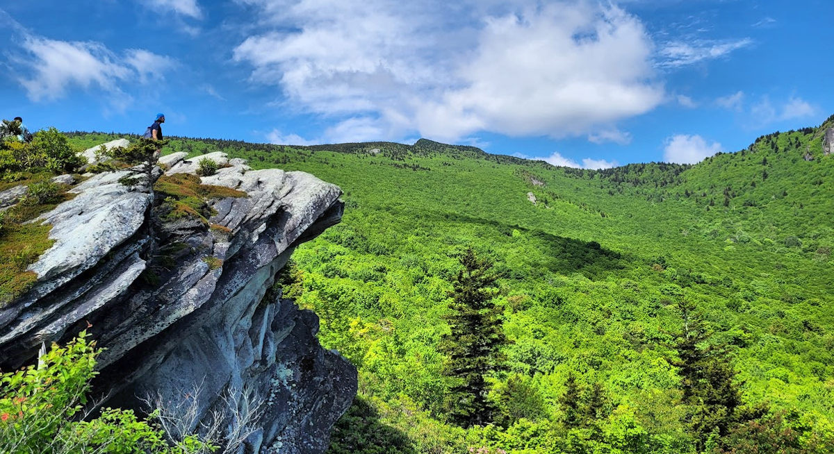
Take a right on the Nuwati Trail and follow it for about 3/4 of a mile to reach Cragway Trail. It’s a gradual ascent through a beautiful forest. Turn left onto Cragway Trail. The trail gets a little steeper, and you’ll hike by multiple large rock outcroppings with panoramic views. About a half mile up the trail is Top Crag View, the largest outcropping with the biggest view of the hike. It’s a great picnic spot (photos at top of page and below).
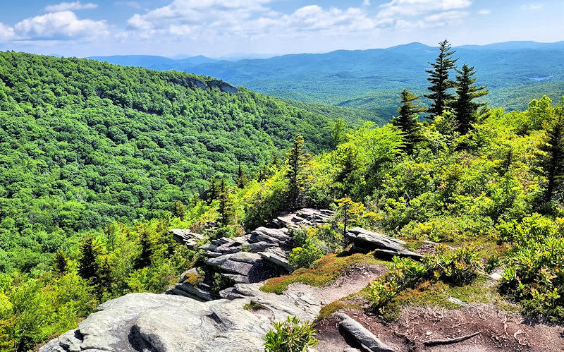
Continue another half mile up to the intersection with Daniel Boone Scout Trail at Flat Rock View (elevation 4,979 ft). See a big boulder on the right to climb atop, but views are limited due to growing trees. Turn left on Daniel Boone Scout Trail and begin your descent for 1.2 miles to return to the Tanawha Trail. Turn left and walk about 6/10 of a mile to return to your car.
Dogs are allowed on a leash. Please stay on the trails since the park’s unmatched ecological diversity that has been recognized as a United Nations International Biosphere Reserve. Don’t attempt to hike during the winter months. Often, the Blue Ridge Parkway is closed. Plus, ice and snow is frequent especially in the higher sections.
Calloway Peak
To reach the top of Grandfather Mountain and extend your hike, turn right onto the Daniel Boone Scout Trail from Cragway to reach Calloway Peak in 1.7 miles (elevation 5,946 ft). This last section is more strenuous with a few cables and ladders to help you. This is a less crowded alternative to the Profile Trail on the north slopes of the mountain near Sugar Mountain. Allow a full day if you add 3.4 miles roundtrip to the 4-mile loop.
Camping
There are several primitive campsites along the trails in this area of Grandfather Mountain State Park. All campsites must be reserved in advance, which can be made as late as the same day.. A fee is charged for all campsites, and campers must have a reservation code to be able to camp. Get details here.
This hike is along our Blue Ridge Parkway Scenic Loop Drive. See more hikes near Sugar Mountain & hiking tips.