
The Tanawha Trail is a 13.5-mile hiking trail along the Blue Ridge Parkway and Grandfather Mountain. It runs from Beacon Heights to Julian Price Park, taking you underneath the Linn Cove Viaduct. Tanawha is the Cherokee word for fabulous hawk or eagle. Completed in 1993, the trail takes you through an ancient ecosystem and a variety of geological terrains ranging from dense forests to rocky outcroppings with panoramic views. Along the way, manmade bridges and boardwalks help both the hiker and fragile plants. It’s just 9 miles from Sugar Mountain.
Since there are many access points to it along the Blue Ridge Parkway scenic loop from Sugar Mountain, you can hike various sections for any distance. For a one-way epic hike, take two cars with one at each end for a full day trek. The trail is strenuous, constantly ascending and descending especially in the southern half. Navigate plenty of steps and tree roots. Elevation ranges from 3,400 feet at Price Lake to 4,700 feet atop Rough Ridge. Most of the Tanawha Trail is part of the Mountains-to-Sea Trail.
Tanawha Trail Parking Areas
- Beacon Heights, Parkway Milepost 305.5: The Tanawha Trail begins near the parking area / overlook for this popular short hike to a stone summit with panoramic views. Read more.
- Stack Rock Parking Area, Milepost 304.8: Connecting trail to Tanawha
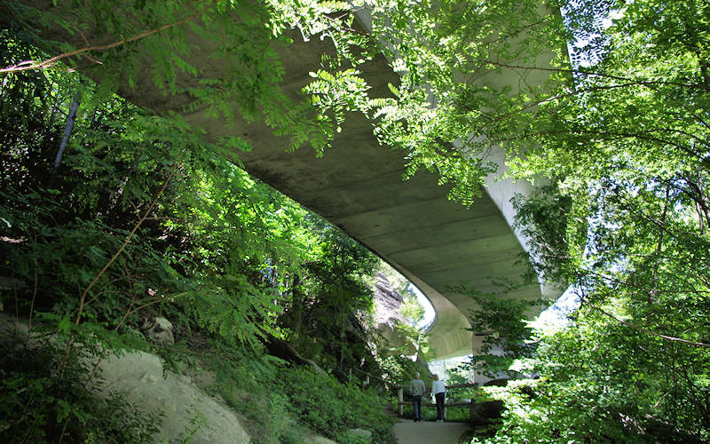
- Linn Cove Viaduct Visitor Center, Milepost 304.4: It’s a short and easy walk to hike the trail underneath the Viaduct (pic above).
- Wilson Creek Overlook, Milepost 303.6: Connecting trail to Tanawha. Head north toward Price Lake to cross the often photographed footbridge
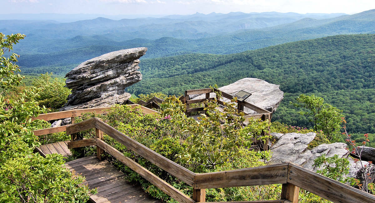
- Rough Ridge Overlook, Milepost 302.8: The most popular section of the trail takes up you a ridge with many rock outcroppings and the best views on the trail. (Pic at very top of page). Read more.
- Boone Fork Overlook, Milepost 299.9
- Cold Prong Pond Overlook, Milepost 299
- Price Lake Campground, Milepost 297: Tanawha Trail ends at the Price Lake campground. Nearby is Boone Fork Trail.
Directions from Sugar Mountain
Take the full Blue Ridge Parkway Scenic Loop Drive or drive directly to Beacon’s Height by turning right out of Sugar Mountain’s main entrance. At the stoplight, turn right onto NC 105. At the next stoplight, turn left onto US 221 North. Follow signs for the Blue Ridge Parkway South, and find the parking area on the left after driving a very short distance.
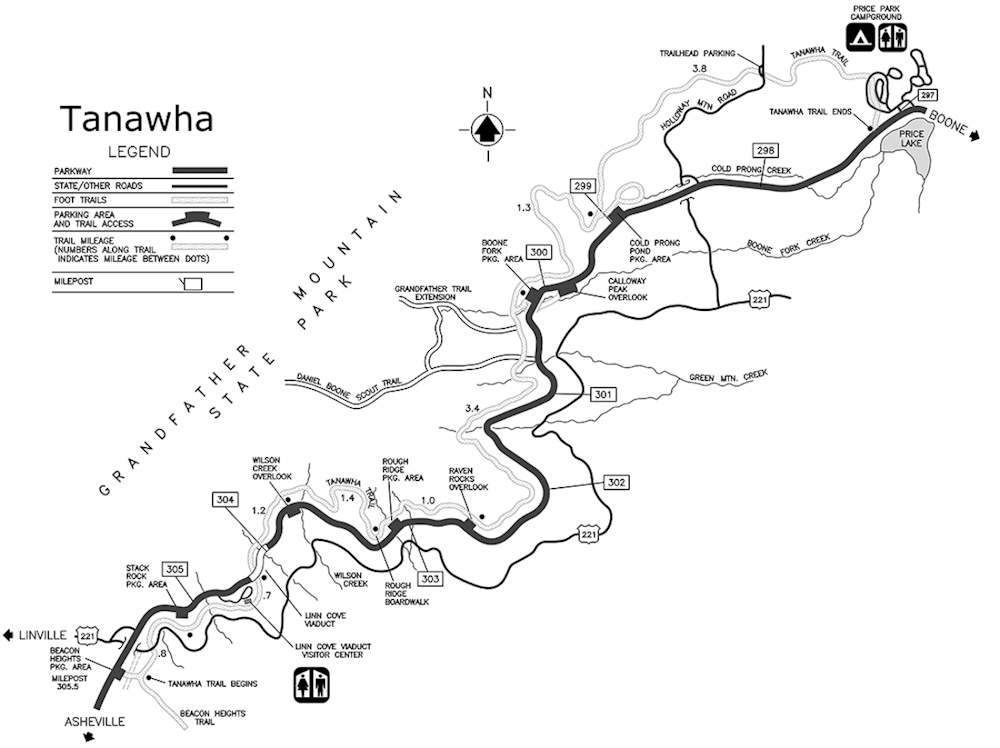
Tanawha Trail Map
More: Find more hikes near Sugar Mountain | Read about the Blue Ridge Parkway Scenic Loop