
One of the best hikes at Moses Cone Memorial Park on the Blue Ridge Parkway is the 2.5-mile Flat Top Road trail to the historic lookout tower on the summit. The park is a scenic 14-mile drive from Sugar Mountain. This is a moderate hike with a continuous gentle climb. Since it was once a carriage road, the trail is wide, smooth and easy to hike – so it’s perfect for easy social distancing with other hikers.

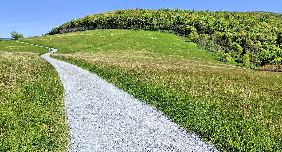
This 5-mile roundtrip hike takes you to the 4,558-foot summit of Flat Top Mountain via wide-open meadows filled with summer wildflowers and lush forests. You gain about 580-feet in elevation, but it’s very gradual with no steep sections since the road was built for horse-drawn carriages on the estate.
Park by the Moses Cone Manor house – now a craft shop and museum. Look for signs for the restrooms / Carriage House. Find the trail behind the building. Turn left onto the trail to go underneath the Blue Ridge Parkway and follow the trail for 2.5 miles.
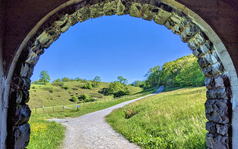
After walking through the short tunnel underneath the Blue Ridge Parkway, you begin your hike through pasture land with beautiful views on both sides. Shortly, you enter a forest as you begin to gradually climb. About a mile into your hike, you will emerge from the forest into a sweeping meadow. Look for a side trail to the left – take a short detour if you want to see the family cemetery. Continue through the meadow that is covered with wildflowers especially in June, July and August. In about a half mile, enter the forest again for the final mile of your hike.
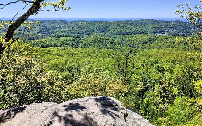
Look for a rock outcropping on your right about 2 miles into the hike for views looking down onto Blowing Rock. It’s a great picnic spot, especially on the way back down the mountain.
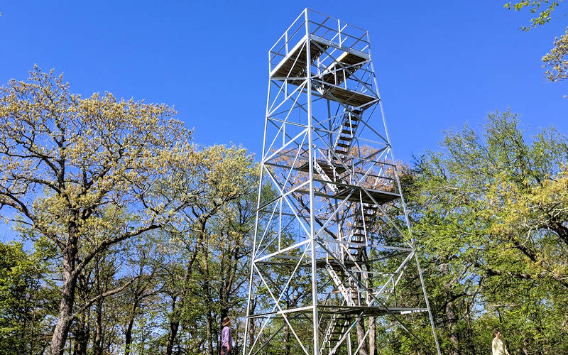
At the summit, climb up the steps of the four-story lookout tower for 360-degree views just above the treetops. On a clear day, you can see south to Mt Mitchell, Grandfather Mountain, Hawksbill and Table Rock peaks. To the north, see the distant buildings at Appalachian State University with Elk Knob and Snake Mountain towering above.
Things to Know
- This hike is along our Blue Ridge Parkway Scenic Loop from Sugar Mountain – see our trip guide.
- See our guide to Moses Cone Memorial Park for more things to see.
- Allow about 3 hours to hike with time to stop to enjoy the views.
- Find restrooms at the beginning of the hike.
- Dogs are allowed on a leash.
- It’s a popular hike. To avoid crowds, go early in the morning. Busiest times are weekend afternoons.
- The parking area is open every day year round unless that section of the Blue Ridge Parkway is closed for snow, ice or repairs.
- Free admission.
- You share the trails here with horseback riders, so please give them the right of way.
- If you want to extend your hike, find many options at Moses Cone Park – home to 25 miles of carriage roads for hiking including Rich Mountain and Bass Lake.
Directions from Sugar Mountain
- Find Moses Cone Park in Google Maps.
- From the main entrance of Sugar Mountain, turn right onto NC 184 South and go 1.5 miles to the stoplight.
- At the stoplight for NC 105, turn left and drive north for 6.4 miles.
- Turn right onto Shulls Mill Road and drive 5.7 miles (paved but curvy) to the Blue Ridge Parkway.
- Follow signs for Blue Ridge Parkway NORTH and go about a half mile to the entrance of Moses Cone Park (Milepost 294).
- Park in the parking area near the Carriage House / restrooms – just past the house.
Places to Stay on Sugar Mountain
Stay in vacation rental homes and condos in the Village of Sugar for the perfect base camp for days of hiking high in the Blue Ridge Mountains. See our list of lodging choices.
More Things to Do
See our Summer Guide and Fall Guide for many more outdoor adventures. See our Blue Ridge Parkway Scenic Loop Drive Guide for more nearby places to go. Discover more nearby hikes & waterfalls.