

Located on our Blue Ridge Parkway Scenic Loop Drive from Sugar Mountain is the Moses Cone Memorial Park, a former summer estate that is now a large public park for everyone to explore. In addition to seeing the mansion that was built in 1901, you can buy art from top regional artists and explore the estate on 25 miles of carriage roads turned trails for hiking and horseback riding.
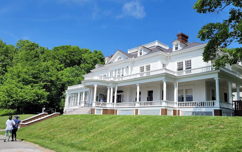
Moses Cone was a textile magnate that was dubbed “Denim King” since his Greensboro NC mills produced denim fabric. He and his wife Bertha built their summer house and named it Flat Top Manor. At about 14,000 square feet, it has 23 rooms and the large porch with panoramic mountain views. The Cones were “naturalists” ahead of their time, enriching their land by preserving and planting many trees. In 1949, the family donated the estate, which is listed on the Register of Historic Places, to the National Park Service.
The Flat Top Manor houses the Parkway Craft Center, representing members of the Southern Highland Craft Guild. See and buy a big variety of art and craft. During the summer, watch artisans demonstrate their talents on the front porch. Speaking of the front porch, find rocking chairs to enjoy the views.
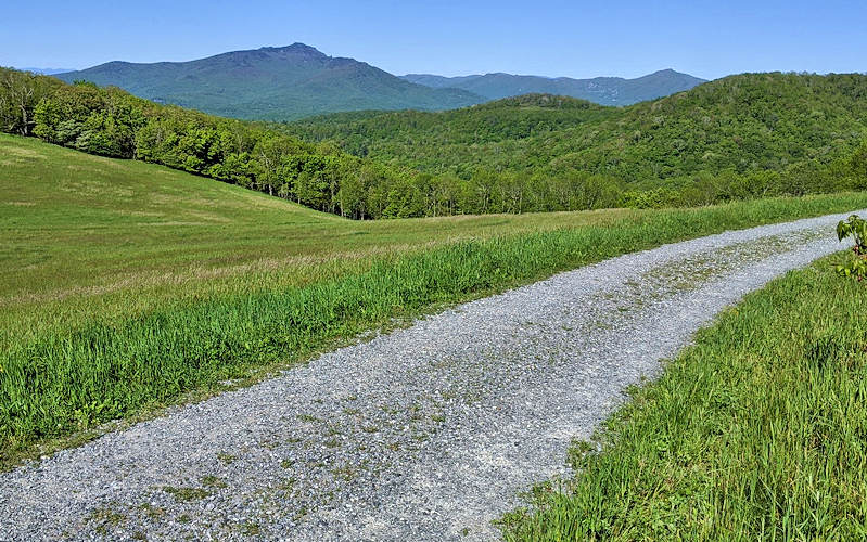
The favorite part of the estate for visitors is the 25 miles of gently sloping carriage roads that now serve as wide, level hiking trails. Hike as little or as much and combine trails for a full day of exploration through lush forests and meadows of wildflowers and to mountaintops and by lakes. No biking allowed. In winter months, it’s a great place for cross country skiing and snowy hikes.
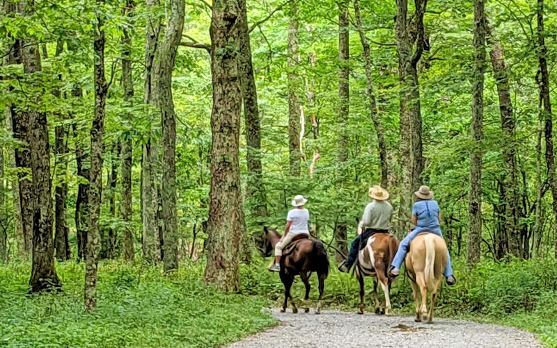
Horseback Riding
Many of the trails are shared by horseback riders. A private business, VX3 Trail Rides, offers a 2.5-hour guided horseback riding trip through Moses Cone Park (approx $120/person). Go to their website for details.
Top Hiking Trails
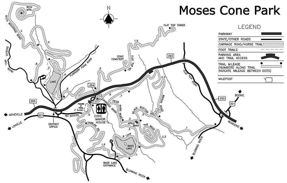
Find three parking areas: Trout Lake and Manor House parking areas are immediately off the Blue Ridge Parkway. Bass Lake parking area is the town of Banner Elk off US 221. The network of trails connect all parking areas.
- Flat Top Road: This 5-mile roundtrip hike begins and ends at the Manor House parking area. The trail climbs gently through meadows and forests to the mountain summit with a 4-story lookout tower. Many mountain views along the way. See our Flat Top Hike Guide.
- Bass Lake: With the connecting network of trails, you can hike an easy 8/10 of a mile loop around the lake or extend your hike with connecting trails to create a 4.5-mile to 6.5-mile loop via Deer Park Road and the Maze by the Apple Barn. For the easy loop, park at the Bass Lake Parking area off US 221. Or park at the Manor House for one of the longer loops. See our Bass Lake Trail Guide.
- Rich Mountain Trail: Start at Trout Lake parking area. You can hike a 5-mile in-and-out or 6-mile loop. The moderate hike has a 600-foot elevation gain. See our Rich Mountain Trail Guide.
Directions from Sugar Mountain
The Moses Cone Park is a scenic 14-mile drive from Sugar Mountain. Nearby on the Blue Ridge Parkway is Julian Price Park with a beautiful lake, trails, picnic area and boat rentals. Free admission. Dogs are welcome on a leash.
- From the main entrance of Sugar Mountain, turn right onto NC 184 South and go 1.5 miles to the stoplight.
- At the stoplight for NC 105, turn left and drive north for 6.4 miles.
- Turn right onto Shulls Mill Road and drive 5.7 miles (paved but curvy) to the Blue Ridge Parkway.
- Follow signs for Blue Ridge Parkway NORTH and go about a half mile to the entrance of Moses Cone Park (Milepost 294).
- Park in the parking area near the Carriage House / restrooms – just past the house
- Find Moses Cone Park in Google Maps.
Moses Cone Park Parking Areas
- Manor House: See directions above
- Trout Lake: Use directions above, but turn left just BEFORE you reach the Parkway and before Flannery Fork Rd. Currently, there is no sign at the start of this one way road that takes you by the lake and to the large parking area.
- Bass Lake: Use directions above, but instead of following signs to get on the Parkway – follow signs for US 221 North. Take it about a mile toward Blowing Rock and look for sign on the left.
Moses Cone Park Trail Map
Nearby
Hike and picnic at Julian Price Park & Lake. See our full guide to the Blue Ridge Parkway Scenic Loop Drive. Find places to stay in Sugar Mountain.
Practice “Leave No Trace” by removing any trash and respecting all plants and wildlife. Read the 7 easy principles.